PENNSYLVANIA, USA —
STORM OVERVIEW:

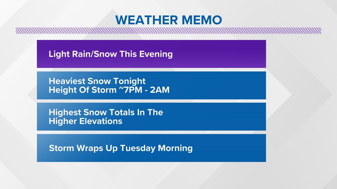
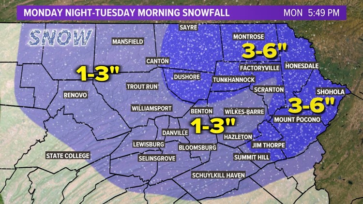
Our storm system has arrived and will continue through early Tuesday morning. Precipitation will be heaviest through 2AM. While valley areas will transition to a wintry mix and rain, the mountains will remain mostly snow. The highest snow totals will be found across the higher elevations of NEPA... particularly in Monroe, Pike, and Wayne counties. Precipitation will taper off early Tuesday morning but linger the longest in far Eastern areas.
WEATHER ALERTS:


The National Weather Service has issued Winter Storm Warnings for Monroe, Pike, and Wayne Counties until Tuesday evening. Winter Weather Advisories are in effect for the remainder of the area until early Tuesday afternoon.
SNOW ACCUMULATION:


A general 1-3" of snow is expected for most of the area. 3-6" of snow is possible across the higher elevations of Northeast PA. In the highest elevations of Monroe, Pike, and Wayne Counties, up to 8" of snow is possible.
STORM IMPACTS:


Given the overnight timing of this event, expect most of the snow that falls to stick. This means that overnight driving conditions will be difficult in the areas that see the highest amounts of snow. Another key to driving conditions will be snowfall rates.


Snowfall rates may approach 1" per hour at times in the Poconos. When it snows that heavily, it makes it difficult for road crews to keep up. That said, driving in the Poconos, particularly rural roads, will be where we see the worst of the driving conditions. Expect improvement for driving through the day Tuesday.

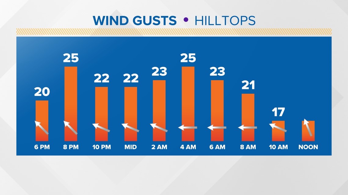
Another thing to keep an eye on tonight is the gusty wind. We may find some gusts to around 30MPH or so. Given the heavy, wet nature of our snow/sleet combo, pockets of power outages are possible.
Overall, this is a relatively low impact event for much of the area. We've seen several storms like this over the winter. The mountain communities see some higher snow totals while the valleys see more mixing. Driving conditions tomorrow morning will be a bit touch and go in the elevations while the valley roads should be mainly wet. By the afternoon, we should all be in the clear.