
PENNSYLVANIA, USA — Winter Storm Warnings are now no longer in effect for Central and Northeastern Pennsylvania.
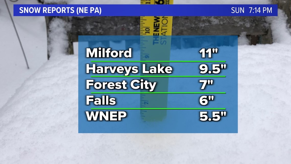
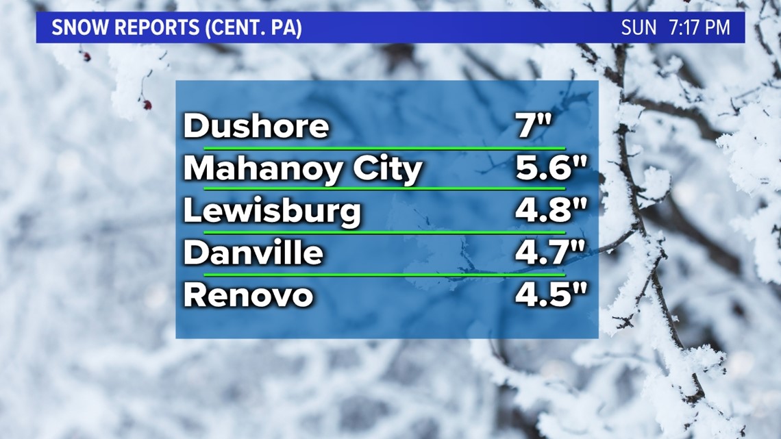
This storm that arrived Saturday afternoon has pulled away and is now bringing scattered snow showers to New England. We picked up an additional inch or two since midnight on Saturday, putting the final totals across the region squarely within the forecasted amounts of 3-6" for Central PA, 4-8" Eastern PA, and 5-10" for the Poconos & Wayne county.
Snowfall totals so far generally ranged between about 4 and 10 inches. We picked up 5.5" in the WNEP backyard. Places like Wayne, Pike and Monroe County saw some of the highest totals.


Looking ahead:

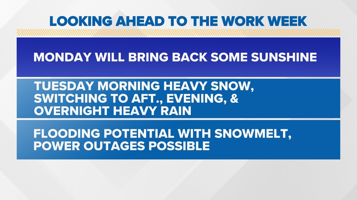
Monday will be a quiet day—clouds in the morning should give way to some partial afternoon sunshine.
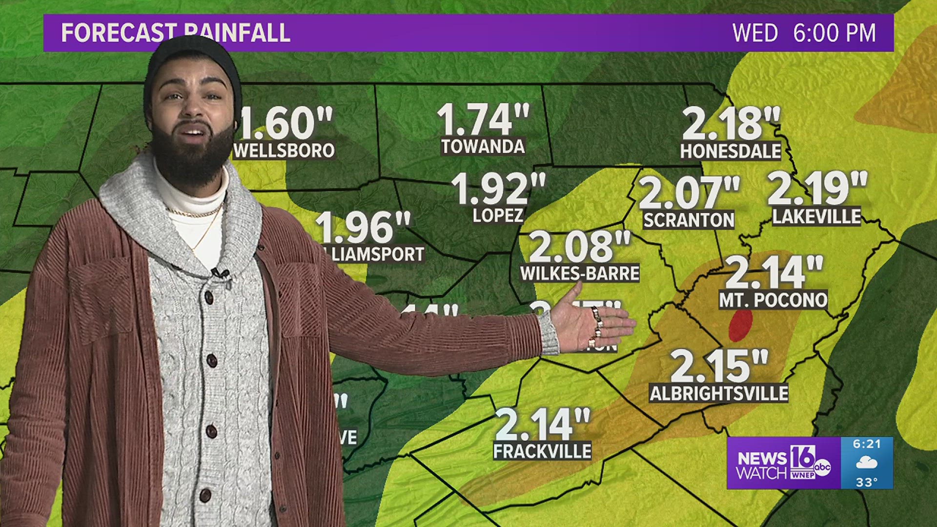
There are several storms that will impact us this week. The first will begin on Tuesday morning, bringing a heavy snow across the region for a brief time until about noon. 1 to even 3 inches of snow could fall over the course of just a few hours.

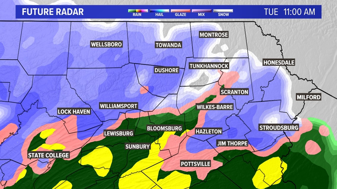
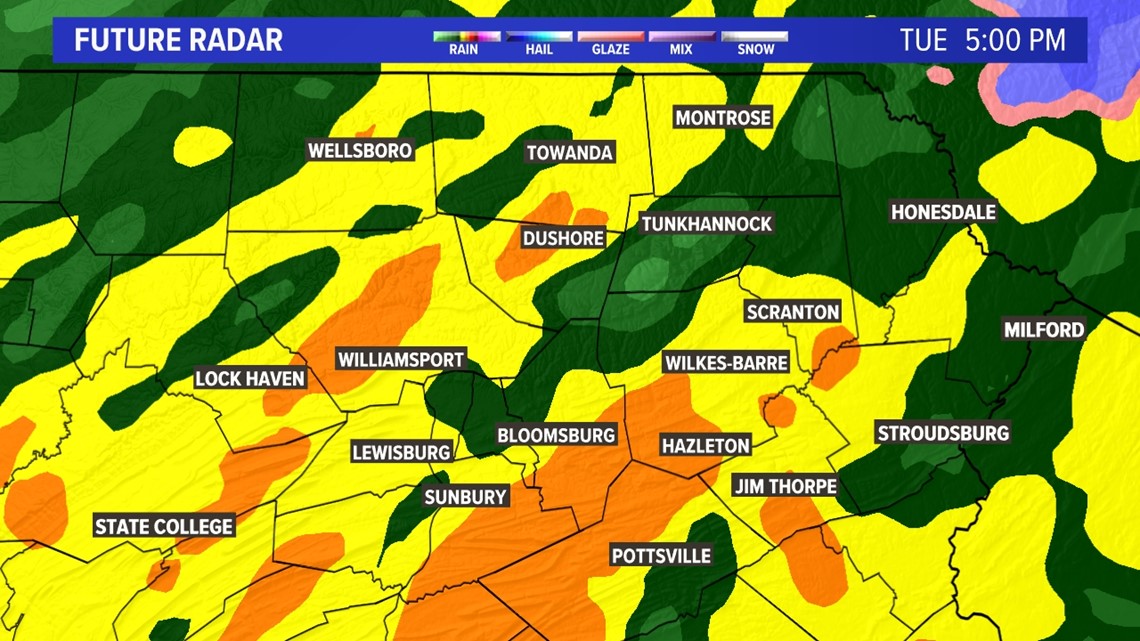
Then there will be an abrupt switch to sleet, and then to heavy rain for the entire region, through the afternoon, evening, and overnight into Wednesday. Prolonged heavy downpours embedded within the storm will likely set up across all of Central and Northeastern Pennsylvania, but the heaviest bands will likely be situated over the Poconos and Southern Tier—some of the same locations that saw the highest snow totals.

With the snowmelt, and several inches of rain expected, there is a Flood Watch in effect for Carbon and Monroe counties.

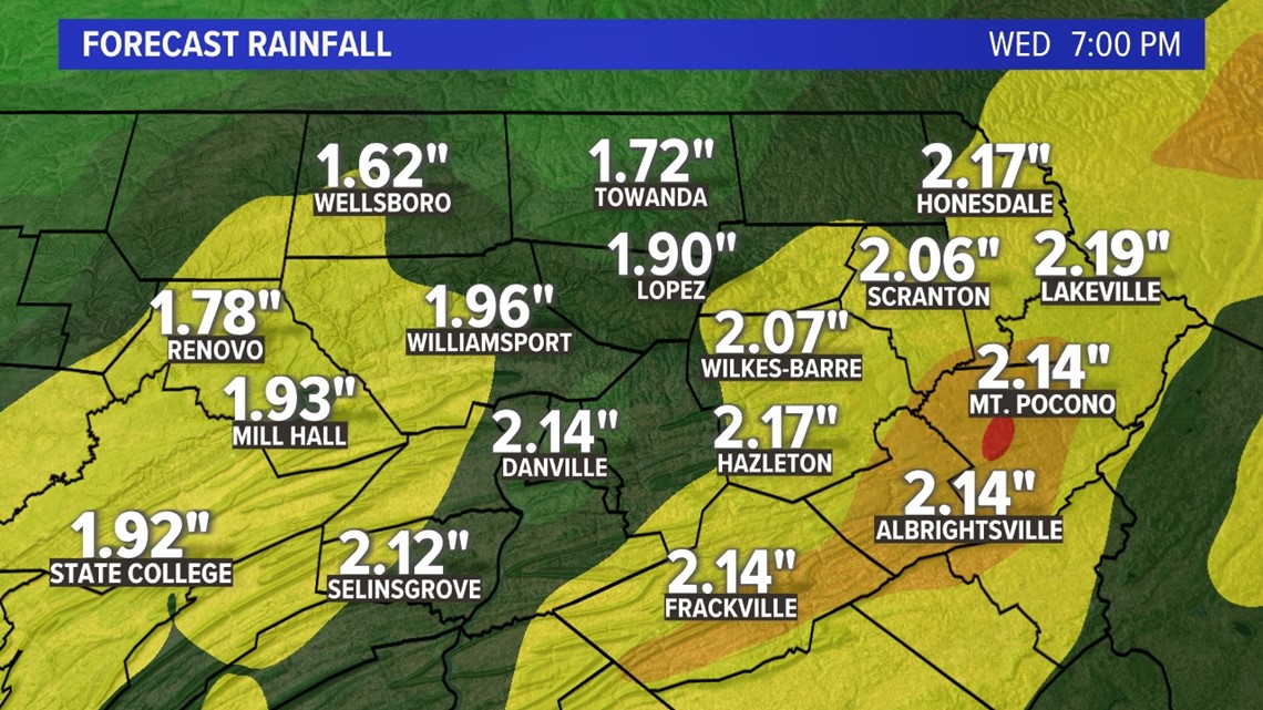

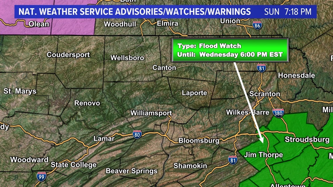
The Flood Watch could be expanded across additional counties if the rain threat increases. A third risk is the winds—sustained at 20-30 miles per hour, and with the potential for gusting to 40, even 50 miles per hour. There exists the possibility of power outages Tuesday into Wednesday, and there will definitely be travel delays.
Another storm will likely move in later Friday into Saturday, once again bringing a mix of rain and snow.
Monday: Clouds in the morning, giving way to some afternoon sun. High 39.
Monday Night: Increasing clouds. Becoming overcast. Low 22.
Tuesday: Mostly cloudy, brief burst of snow in the morning, changing to sleet and then heavy rain for the entire evening. Gusty winds. High 46.
Wednesday: Trailing rain and snow showers in the morning coming to an end, windy. High 45.
Thursday: Partly sunny and breezy. High 40.
Friday: Partly sunny. A mix of rain and snow possible late at night/overnight. High 42.
Saturday: Watching another potential storm that brings a mix at first and then rain. Gusty. High 45.
Sunday: Lingering flurries. High 31.
Full Forecast:
CLICK HERE for our Interactive Radar and get the latest Stormtracker 16 Forecast HERE.